Geographic Information System
Geographic Information System (GIS)
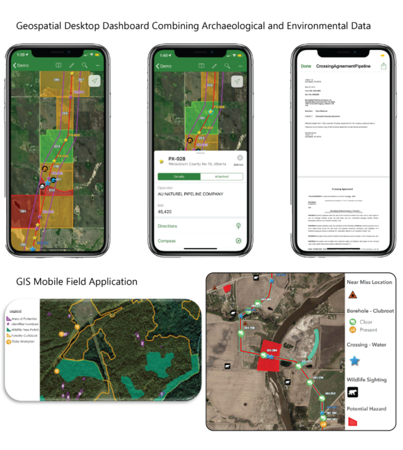
Data management is a crucial component to extend efficiencies for H3M’s projects. The data H3M works with is spatial in nature and knowing where a specific landscape feature or artifact is in relation to a proposed industrial project is essential. To help visualize, analyze, and communicate the numerous variables that can influence the placement of an industrial project H3M uses a Geographic Information System (GIS).
Our projects often require management of large quantities of data and seek to solve that challenge for our clients especially during the critical planning and construction phases. To effectively and efficiently manage, reference, edit and analyze field collected and freely available GIS data, H3M has found success using Web-Based GIS tools. These tools allow for seamless data collection and analysis by integrating mobile data collection in the field and combine with available layers from our online database to provide real-time feedback in GIS format. Once the field data has been collected and uploaded into the database, the Project Manager can review the data to verify the completeness and quality of the data through online web mapping applications.
For our projects, H3M favors using web-based service over the traditional maps-based solutions. The rationale behind this decision is:
- Web-based solutions are dynamic
- Data can be referenced at many different scales
- Layers can be toggled on and off to make it easier to focus on specific datasets
- Allow consideration and exploration of areas adjacent to the project footprint
- The data within the attribute tables are accessible to all parties and decision makers
- Accessibility-wise, can accommodate multiple users at one time, as well as from the field in their tablets/devices or from a desktop.
- Efficient handling of updates to datasets in real-time (i.e. project footprint changes)